Category Archives: Uncategorized

A Brief History of Ore Village

Excerpts from ‘A Brief History of Ore Village’ – a talk given on 17th July 2024 by Karen Draper and Debbie Jones of Fairlight History Group.

There is no evidence of a village of Ore before the Norman Conquest, though the name is an Anglo-Saxon word Ora, describing the landscape.  There are many other places in England with names derived from the same word, mostly small, and in common they have hills of a particular shape – long with a flat top ending in a shoulder at the end, this exactly fits “The Ridge” locally.  

The place is not mentioned in the Domesday Book so it was either undeveloped or included in another estate.  It is recorded first soon after 1100 in a person’s name: Ailric de Ore who paid part of his tithes to Battle Abbey and was no doubt Lord of the Manor of Ore – later known as Ore Place.  His overlord was the Earl of Hereford, Humphrey de Bohun, son-in-law of King Edward 1.

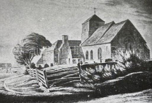
St. Helen’s Church was built close to the manor house for the convenience of the Lord who both appointed the priest and paid him.  The church would be attended by his family, his labourers and tenant farmers, but it would not have been the centre of a large settlement.  Like other parishes in the area, Ore always consisted of scattered farms and tenements.

Fairlight Down was not in the early days part of Ore parish, but common land of the people of both Ore and Fairlight – another Anglo-Saxon descriptive name, which originally was Fearnlegh, the bracken clearing.

The original location of Ore, shown on early maps, was a mile away from the present village, around the old parish church of St. Helen’s. By contrast, maps from the last century show Ore marked close to the present Christ Church, Ore.  The old church was very popular with visitors from Hastings in the first half of the 19th Century when the evangelical preacher, Rev. Doctor Fearon was Rector there.

It was usually approached by way of Ore Lane (now Elphinstone Road) and the large house called Oakdene (no 109) was the old Rectory.

Bullock in his history of the old church quotes from a booked called “The Land We Live In” by Charles Knight (1847)

“Among the short walks inland from Hastings, none is pleasanter than that to the pretty village of Ore.  Your way to it lies along shady green lanes, and the church tower rises as a landmark before you for nearly the whole distance. 

The village itself consists of merely a few humble cottages and a farmhouse or two, but they have a rustic picturesqueness about them that is very pleasing’ and with the church, form a good object to ramble after.  The old church stands of an eminence by a broad, breezy common, and from both churchyard and common, there is a wide and excellent prospect”.

The old church fell into ruins after its replacement – the present St. Helen’s was built in 1870, but in 1902 and at least once a year for many years afterwards, an open-air service was held there.

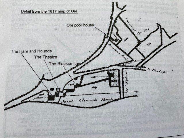
 A survey and valuation of the tithes belonging to the Rectory was prepared in 1817 containing maps and descriptions of land, property and occupiers in Ore.  A few buildings were marked along the turnpike road including the original Hare and Hounds public house, and the Play House both owned by Thomas Button.  Close to them stood the Smithy’s shop owned by John Stacey.  Following the main road round the next major building was the White Mill, standing just past the junction with Winchelsea Road.  Apart from a few small cottages in Middle Road and Fairlight Road, the rest of the village was fields.

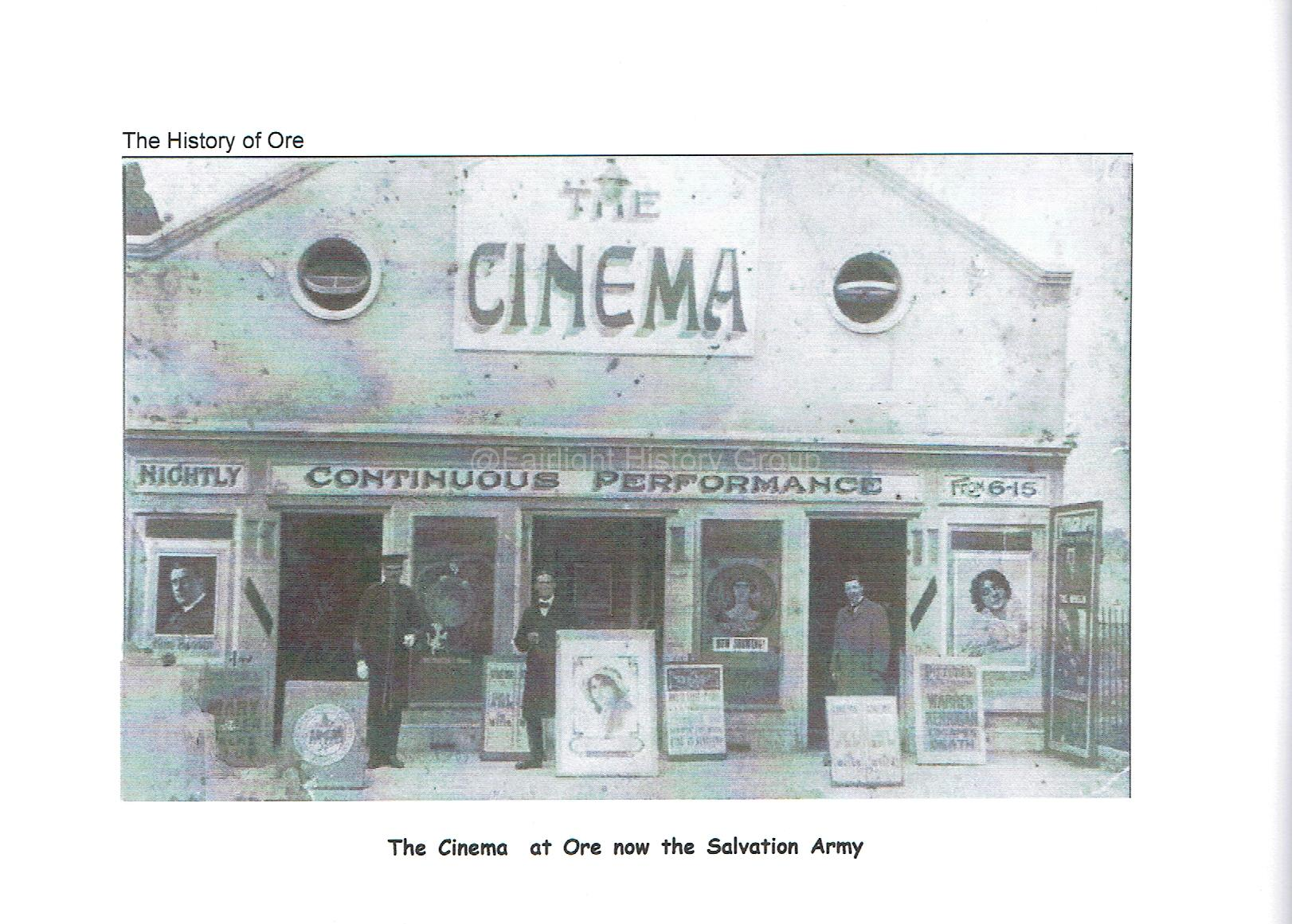
The modern-day location of Ore Village has only been the nucleus of the settlement for the last 200 years. Prior to this, the settlement was extremely rural and sparsely populated. It was heavily wooded (Coghurst Wood being a remnant of this) and mostly farmland. Where present-day Ore Village is located was originally known as Fairlight Down, an open area of scrubland surmounted by a windmill and crisscrossed by tracks. By the 1700s buildings started appearing in present-day Winchelsea RoadMiddle Road and Fairlight Road. There were several windmills in the vicinity including Fairlight Mill built in the 1700s, rebuilt in 1819 and burned down in 1869 (it stood where present-day North’s Seat is); White Mill (also known as Cheale’s Mill) built in 1813 and burned down in 1900; and Black Mill (Down Mill) built in 1855 and demolished in 1918. Until 1859 the only place of worship in the district was the 12th century St Helens Church (decommissioned and rebuilt nearby in 1869) one mile away along the Old London Road – now called The Ridge – but in 1859 Christchurch Ore was built. For a brief time in the early 20th century Ore Village even had its own Cinema – originally called The Princess then became The Cynthia – which was later closed, the site being bought by the Salvation Army.

Ore Village School was constructed circa 1851 as a mixed national school. From 1867, street directories list both a national and Infants school in Ore. The Ore School Board formed in 1878 to govern the running of the school, holding monthly meetings. In 1883 a meeting of the school board heard that further accommodation was required, possibly leading to the rebuild in 1886 when separate boys’ and girls’ infant’s departments were created. At that time, the board of the school consisted of the following persons; The Rev. D. A. Doudney, Jun., president, Messrs. G. A. Thorpe, Spalding, Gibson, Beck (Clerk), and Gilbert (School Attendance Officer). In 1888, there was a proposal adopted by the board that a new school on the Sandown site for accommodating children of the parish between the ages of 8 and 13, census records showing that there were some 348 children in the catchment area that were not receiving any schooling at that time.

In 1897 the Hastings United District School Board took over the running of the school and by 1899 it had accommodation for 250 boys, 170 girls and 200 infants, with the school situated in Old London Road. Following the 1902 Education Act, during 1903, it came under the control of the Education Committee of the Borough of Hastings. The boys’ section of the school was closed in December 1925. The girls’ section subsequently became a Senior Girls’ School, then a Secondary Modern School and finally a Community Centre.

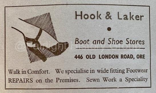
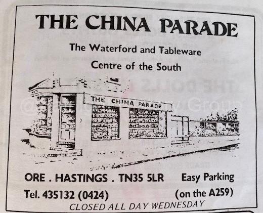
Adverts found in old copies of the Fairlight Church News

The Expenditor of Pett Level

The Expenditor of Pett Level By Paul Draper for Fairlight History Group

On 30th March, a small group of us from Fairlight History Group travelled in separate cars to Dymchurch to visit the New Hall. Despite its name, the building was first constructed in 1575 to house the Corporation of the Lords, Bailiff and Jurats of Romney Marsh. Although the Corporation has been known by many different names since its formal Royal Charter in the year 1252, it still exists and today the full title is the Romney Marsh Area Internal Drainage Board. Their area of responsibility has been greatly extended to include the Brede and Tillingham valleys, plus Pett Level and just into the Parish of Fairlight (see map).

A map showing the full extent of the modern day Romney Marsh Area Internal Drainage Board. Board members are selected from Folkestone and Hythe, Ashford and Rother District Councils, plus Denge and Southbrook, Oxney, Lydd, Walland and Pett.

A map showing the full extent of the modern day Romney Marsh Area Internal Drainage Board. Board members are selected from Folkestone and Hythe, Ashford and Rother District Councils, plus Denge and Southbrook, Oxney, Lydd, Walland and Pett.
How did we become interested in this subject? Well it all started last Autumn when we received an enquiry from Australia about a Thomas Thorpe, whose occupation was stated as “Expenditor of Pett Level”. The research specifically concerned the family of Thomas Thorpe but it alerted us to the existence of the function of an Expenditor, a totally new occupation to us. We started to investigate and found little information available online, but there were several others scattered around the country in areas known for their marshes and levels. It seems that the main responsibility was to oversee the maintenance and clearance of all the secondary waterways, the collection of any taxes or scots and the expenditure of the monies collected. (NB. Hence the expression “Getting off scot free”).

We found our man Thomas Thorpe in all the census returns from 1841 to 1881 but his occupation is only listed as Expenditor of Pett Level in 1861, whilst resident in Westfield and in 1881, whilst resident in Hastings. The surprise was that he did not actually live at Pett Level. In fact, he and his wife were stated as “Lodging House Keepers” in Hastings in the other returns, so this was not his only job.
Today, the honorary function still exists under the single title of the Expenditor of Romney Marsh, which includes all the waterways shown in the above map. The current holder of the title, is a Mr. Rod Nickerson.

The Story of John’s Seat


John’s Seat, Fairlight, photographed in 2015

In answer to a frequently asked question “Who was the John after whom ‘John’s Seat’ was named?”, we quote the answer as given in 2004:-

Fairlight News 156 – September 2004

“I would like to thank John Burford for repairing John’s Seat situated on the cliff walk to Pett Level.

I am sure many of us are grateful to be able to sit in comfort once more and enjoy the wonderful panoramic view of Fairlight Cove. – Brenda Dwyer.

Nb. Editor’s note: I have been asked whether I know who John’s Seat is named after. If anybody knows, please let me know.”

Fairlight News 157 – December 2004

“John’s Seat, Fairlight

This bench was erected in 1994 as a final project and in fond memory of John Parratt, local artist and late headmaster, 1927 – 1993.

John, his wife Gill and their two daughters spent holidays and free time at their cottage in Mount Pleasant Farm, Guestling Green, which John had found during his time as Deputy Headmaster at St Paul’s Primary School, St Leonards.

John, in his final months of illness, devised projects for his various friends. Ours was to negotiate the erection of a seat or bench in his chosen area of the Fairlight Coastal Path, where he had spent many hours sketching and painting in watercolours, usually accompanied by his little spaniel, Jasper.

A dictat of the National Trust would only allow a rustic type of bench with the simplest of dedications, so John’s Seat was carved into the facing edge plus, of course, the oak leaf emblem.

Alas, where was the apostrophe, that would not do for a memorial to the late Headmaster of Wrotham Primary School. A cabinet maker friend of John quietly made the correction.

One sunny lunchtime in the summer of 1994 Gill, daughters Sarah and Julia together with family and good friends saw the bench well ‘christened’ and well seated.

We hope it will remain, so once more, well done John Burford.”

We hope the above answers the question. (Please note that the land is owned by the National Trust).

By Paul Draper

The Sargent Family From Fairlight Return After 157 Years

The Sargent family from Fairlight return after 157 years by Paul Draper (previously published in Fairlight News in 2015)

Background:-

The Sargent clan are all descended from John and Sarah Sargent, who lived in Fairlight between 1818 and 1858. At a time when they already had eight children, John decided they should emigrate to the USA and he left in 1857, via Bristol and sailed away onboard the ‘Eagle’. He established himself at a small town called Rushville in Midwest Illinois and in 1858 sent for his wife and children. Somehow she managed on her own (he did not come back for them) but we cannot find their emigration records. They were reunited at Frederick’s Landing, Illinois and made their way to Rushville where they settled and then had another five children!

Their story has been particularly interesting to study because John and Sarah were married in Fairlight old church on 9th October 1842. Their first child, Sarah, was baptised in the old church on 1st August 1843, their third child, Elizabeth, was baptised on 27th June 1847 in the new (current) church, but where was their second child, John, baptised? At the time of his baptism, 17th July 1845, the old church had just been demolished and work had commenced on the new one. So where did his baptism ceremony (and nineteen other baptisms in the building period) take place? We do not know for certain.

In the 1841 census, the unmarried John, aged 23 was living with his parents, John and Elizabeth in ‘Rosemary Lane’. (Research suggests that the house was probably either Little Stonelink or another long-since demolished building just opposite). In the 1851 census, John, now married to Sarah, is living at ‘Waites Farm’ with their first five children. (In 1851, there are three separate households called ‘Waites Farm’, but recent research suggests that John and Sarah were living in the property now known as ‘Waites Old Farmhouse’).

The 2015 visit:-

Last September Jim Sargent emailed Richard Barron, Rector of Fairlight and Pett, and advised him that he and his family intended to visit Fairlight in June to see where John and Sarah had lived. Over the following weeks and months we exchanged information and slowly put together a plan. They also have roots in Pett, Battle and Wittersham.

Day 1. Finally, on 8th June 2015, at 1.45pm, their minibus pulled up in the carpark outside St. Andrew’s and eleven members of the Sargent family set foot on Fairlight soil for the first time since 1858. They were greeted by Richard and Kath Barron, Paul Draper. the FRA Archivist, his wife Karen and local historian, Haydon Luke.

We showed them the church, the graveyard and took ten of them up the tower to see the magnificent views. After a brief visit to the old coastguard cottages, we then drove to Waites Old Farmhouse. The present owners, Brian and Daphne showed them the house and garden with particular emphasis on their original well in the back garden. There then followed a short ceremony. Jim and his family had collected some water from the River Illinois at Frederick’s Landing, the point where the family had landed in 1857/8, and Jim had somehow brought the bottled water through US and UK customs to Fairlight. We all took it in turns to pour a few drops of water down the well to symbolise the return of the Sargents to their original family home. Many photographs were taken.

The minibus then took us down Rosemary Lane to see Little Stonelynk. The owners, Roger and Susan, told them about their house and the art of thatching and again many photographs were taken.

Next, the minibus took us to Pett church where they were greeted by local Pett historian, John Taylor. He gave them a short talk on Pett and the church and then we adjourned to John’s house where he and his wife, Ray, provided tea and cakes.

Day 2. After an early morning visit to Wittersham, the minibus arrived at the Fairlight Lodge Hotel at 2pm where we once again greeted them for an afternoon of entertainment. The eleven Americans were joined by a total of eighteen ‘Brits’.

Firstly Jim led us all outside where they announced that Paul Draper and Paul Lamb, the minibus driver, on behalf of Back Roads Tours, were presented with T-shirts marked ‘ Sargent 2015 England Tour’ and both declared as ‘Cousin Paul’!

Next, Haydon Luke gave a photo presentation and talk on the history of Fairlight. Then, Jim and his daughter Linda organised a ‘get-to-know-you’ session called five five five. Each American spent five minutes telling one or two Brits about their own story and then, after five minutes the roles were reversed and so on. A simple but effective way for everyone to introduce themselves, but quite noisy!

High Tea was provided by Nicola and Maggie. What a magnificent spread we all enjoyed! To complete the picture, Maggie and Nicola presented our eleven guests each with Union Jack coloured Mad Hatter tea-party top hats.

Then we all adjourned to the bar where Kath Barron took to the piano to play two songs requested by the Sargents. Firstly, ‘Stilling the sea’, a hymn sung by the Sargent children in 1858 when their ship was apparently in difficulties in an Atlantic storm. Secondly, ‘The White Cliffs of Dover’. Words and music were provided but we all knew the words to the second one!

To end the afternoon, we all went outside for a selection of group photos.

In the evening we had a farewell meal at the Two Sawyers. (The Two Sawyers played a significant role in the Sargent family history. Formerly part of Fairlight, some of the Fairlight Vestry meetings, determining the future of the poor of the village, were held there. John Sargent’s parents were themselves declared poor and the whole family sent to the Poorhouse on the 25th December 1830.)

Everyone thoroughly enjoyed the ‘Sargent 2015 England Tour’ and Jim announced that he will persuade all those other Sargents back in the USA to make this an annual event!!

By Paul Draper

Fairlight UK and the links with other Fairlights in Australia, New Zealand and Canada

Fairlight UK and the links with other Fairlights in Australia, New Zealand and Canada by Haydon Luke.

But first of all, where is Fairlight, UK?


Fairlight UK is located on the south east coast of England with a view over the English Channel. On a clear day the French coast at Boulogne can be seen.


Fairlight, East Sussex, England, is a small village on the English Channel coast about 3 miles east of the seaside town of Hastings.  Its population at the time of the 2011 census was 2,259 people and the area of the parish is around 613 hectares.

The history of human habitation in our home area goes back a long way even to Mesolithic times.  Archaeological evidence of hunter-gatherers has been found in our fields and on the cliff tops. In terms of recorded history the church dates back at least to 1180 though the present structure, St Andrew’s, is a Victorian re-build from 1846. Several fine farm buildings date back at least to the Tudor period

Until the early 20th century ours was a sparsely populated farming area but in the 1920s as a consequence of the agricultural depression following World War 1, one of the farms was sold off for housing development and this led to a sharp increase in population though the area still retains its essentially rural characteristics.

In the 19th century the population was much smaller, around 25% of today’s figure, and life was challenging especially in the years when British agriculture experienced depression.  Families were large and in many cases younger family members, men particularly, were attracted by the opportunities overseas in the USA and in the Empire, especially countries such as Australia, Canada and New Zealand.

So it was that men and women from a small Sussex community found their way to those other countries far away from their native shore and made new lives there.  Not all were successful, but many were.  In the case of the three Fairlights in the old British Empire, those founding the new communities felt impelled to commemorate their place of origin in the name they gave to their new homes.

The part played by three such men in the founding of these other Fairlights is each different but joined perhaps by a common thread of determination, adaptability and courage in the face of the undeniable challenges posed by life on the frontier in new and developing lands.

What do we know about these other Fairlights and their connection with this little Sussex parish?

Fairlight, Manly, NSW, Australia.

The largest of the three is in Australia.  It has a population of almost 5,500 and is attractively situated on the water of the Sydney Harbour inlet and is a small part of the district of Manly – itself a major suburb of Sydney.  It was first settled in the mid-19th century.  Fairlight’s namesake was in fact a house, the home of Henry Gilbert Smith (1802-1886) who is regarded as the founder of Manly.

North Harbour from Fairlight, c. 1907, ©Manly Local Studies Library


Smith had prospered in business in Australia and in 1853 bought 26 acres of land on the eastern side of the Cove.  He first built a small 4 bedroomed cottage and wrote in 1855 “I am now spending a good part of every week at Fairlight…it is a most delightful spot, admired by everyone for its beauty.” This is thought to be the first time the address Fairlight was used.  Then, about 5 years later, around 1859/60, Smith had a larger house built.

The house he had constructed was an elegant, Georgian style sandstone mansion, two storeys high and five windows wide, with tower and veranda, set in park like grounds on the waterfront at Fairlight.  It was designed by a well-known Sydney architect, Edmund Blacket and completed in May 1860.  It was Smith’s first wife who was born in our parish and he named both the house as well as the settlement Fairlight in her honour.

Fairlight House with guests, image ©Manly Local Studies Library       


The local history says of Smith and the founding of Fairlight: “Fairlight House was the original home of Henry Gilbert Smith. Its original design was a traditional Georgian design, with two storeys and five windows. It originally occupied 36 acres, of what is now known as the suburb of Fairlight to and including what is now occupied by Manly golf course.

Henry Gilbert Smith was the first to recognise the potential of Manly as a resort area for those wishing to temporarily escape busy Sydney. He planned the Corso, the street that connects Sydney Harbour with the Ocean. He also had the Norfolk Pines planted that line the beaches of Manly and had hotels built along the Corso.”

After the death of his second wife who died at Fairlight House, Smith returned to England and to Sussex in 1867.  Fairlight House survived until 1939 when it was sold to a builder who demolished it and put up flats [apartments] on the site.  The name, however, just survives because a road named Fairlight Crescent actually crosses over the land where the house formerly stood.

After Smith sold up, Fairlight grew slowly until a tram route was developed around the time of the First World War after which the settlement started to increase and, as Sydney got bigger, it became a flourishing community.  So in that respect the development of housing in Fairlight NSW and Fairlight UK were broadly in step.

Another similarity is, of course, proximity to the sea and all that brings both in terms of happy seaside recreation and the less pleasant possibility of shipwrecks.  Throughout its history Fairlight UK has seen its fair share of wrecks and rescues and, because of the proximity of the English Channel, this was particularly the case during wartime.   

Fairlight NSW can match Fairlight UK in that respect, too, when in 1949 the Dutch submarine KXII ran aground on the foreshore.  The submarine had had an active World War 2 career having sunk at least 3 enemy ships and then been damaged during the Japanese assault on Indonesia in 1942.  It limped back to Sydney with difficulty, was repaired but declared unfit for further service and sold off, subsequently becoming a tourist attraction moored off Manly.  Admission; one shilling!

In June 1949 whilst being towed to a safer location “wind and swell combined to break the tow-line, and it ran aground on the sand at Fairlight broadside on.” Fortunately there was no loss of life but for a year the submarine lay beached at Fairlight becoming something of an informal playground for local children.  Eventually the wreck was bought up for salvage, broken up and with some irony sold off as scrap to Japan leaving only memories behind.

Photo of the K XII aground off Fairlight Beach, c.1949.

Photo ©John Cowper


Fairlight, Southland, New Zealand.

Earlier I said that some folk from our tiny parish were adventurous and got about a bit in the 19th century.   That was certainly true of John Howell, the local man responsible for the founding of Fairlight, New Zealand.

My quest for information about this Fairlight began with an unattributed photo in the Fairlight Village Archive showing what appears to be a tiny and remote railway halt.  There is no other information on the photo which is clearly fairly modern.  No one associated with the archive knew anything about the photo and it was clear from the research we had done on the Australian Fairlight that there was no railway there.  Could the location perhaps be New Zealand?

Last November my wife, Elaine, and I were lucky enough to go to New Zealand on holiday and whilst there we discovered, quite by chance when studying our route on the map, that, lo and behold, there was Fairlight!  It lay on our intended path south from Lake Wakatipu close to the border between Otago and Southland provinces and we would pass through it on our way to explore some of the fiord lands in the south west of South Island.


Fairlight, Southland, New Zealand.


So it was on 16th November 2014 that I found myself standing on a tiny station platform which in all respects matched the photo in the Fairlight Archive.

Fairlight station is in an isolated location on a plain but close to mountains and would not have looked out of place in Scotland.  There was little else in the area save for a section of track, a hiking trail, a few isolated agricultural buildings and, in the distance, sheep. We explored the immediate area and it was clear that the station was no longer in use.  We were intrigued and resolved to find out more, knowing we would come along the same road in a few days’ time when we headed back to Queenstown.

So, on our return we investigated further.  We were keen to establish whether there was a definite connection between our parish and the place we had found on the other side of the world.  Helpful librarians in Queenstown aided us and we learnt that Fairlight had been a halt on the 19th century railway from Invercargill, the port on the far south coast of South Island, north to Kingston on Lake Wakatipu.  The story of the line went back to the discovery of gold in the Wakatipu district in 1862 and the consequent need to improve communication between Invercargill, which was the access port, and the area round the lake. 

So far, so interesting.  But how did this remote settlement come to be called Fairlight?  Our investigation took two forms.  First, we went back to Fairlight Station to explore more thoroughly ‘on the ground’ and, second, we decided to follow up local sources in the museum at Arrowtown near Queenstown which we had been told had a lot of material on the early settlements. 

On the ground we found that in recent times the section of the railway from Kingston to Fairlight had been revived as a heritage railway but unfortunately it no longer operated.  However, we also found an intriguing signpost pointing to a Fairlight Homestead and indicating that it was on a heritage trail.  A few hundred metres further on and there it was – Fairlight Homestead, complete with sheep. 

Sadly, a sign warned us that the property was private and not open to the public. Our disappointment at that was tempered by our excitement at what we read.  The heritage trail plaque told us that the homestead was the centre of a vast 30,000 acre sheep ‘run’ and, although originally called Bucurochi, the run had been purchased in 1860 “and renamed Fairlight by the famous Captain John Howell after his birthplace on England’s Sussex coast, from where he had set out to sea on whaling ships.  Howell commissioned the construction of a Georgian style homestead which stands today.”  We felt as though we had hit the jackpot.  Not only did we have proof that Fairlight, NZ, was indeed named after ‘our’ Fairlight but there was clearly more of a story to be uncovered about ‘famous’ Captain John Howell himself.

At the museum in Arrowtown we found more leads and much fascinating material about the lives of the early settlers and the challenges they faced developing their lives in a new country.  After we returned to the UK we made further enquiries to the New Zealand Government Department of Conservation and had another bit of luck.  The officer who responded to our query, Rachael Egerton, had a personal research interest in Captain Howell who, she said, is somewhat of a legend in Southland, being one of the earliest European settlers, and very important in many other ways as a pioneer pastoralist and businessman. Many trace their ancestry to him”.  This latter point is given impetus by the fact that he had 19 children by two wives!

Rachael gave us some further leads to follow up from which it was clear that John Howell had indeed          

been born in Fairlight in 1809.  Local Records, now in the East Sussex Records Office at The Keep, confirm this. The entry in the Dictionary of New Zealand Biography takes up his story.

“John Howell was baptised at Eastbourne, Sussex, England, probably on 8 July 1810, the son of William Howell and his wife, Mary Collings. At the age of about 12 he stowed away on a smuggling vessel; apprehended on the vessel’s return from France, he was released when found to have no connection with the smugglers. He promptly stowed away on a ship bound for Australia, became first mate on a whaling ship, and arrived at Kapiti Island, New Zealand, in 1827 or 1828. Here he engaged in whaling and the export of greenstone to Australia.”

In the late 1820s and 1830s, then, he was active in the whaling business which in those days thrived in the southern oceans and, whilst fraught with great danger, was also capable of delivering to successful ships’ captains great wealth. Later, as whaling declined, Howell turned to agriculture making good use of the land he had acquired at Fairlight. Howell was also involved in developing political and personal relations with the indigenous Maori population across the racial boundaries.  Indeed, both his wives were Maori.

Over time, the Howell family came to be seen as social and economic leaders amongst the developing colonial settlements and pastoral economy in that part of New Zealand, at a time when many mixed race families found themselves increasingly marginalized.  Such was the significance of the experience of Howell.

Fairlight Station Homestead © NZ Historic Places Trust. Photo taken 1996.

and his descendants in managing to live and thrive ‘in between worlds’ that they have become the focus of serious academic study which explores the way they made the transition from leading members of a mixed community to, in effect, colonial gentry.

It is interesting to reflect on the fact that a son of Fairlight should make such an eventful life on the other side of the world, playing a significant part in shaping his adopted country.  On his death in 1874 his newspaper obituary stated that “Captain Howell has left a very wide circle of friends.  He was universally respected by all, both rich and poor; his purse was always ready for any charitable object, as was his home for many years free and open to any who pleased to call.  In Captain Howell, Southland has lost a treasure.” (Bruce Herald, Vol VII, Issue 623, 14th August, 1874, p.7)  His second wife survived him by 25 years, dying in 1899.

140 years after his death, it is clear that ‘our’ Captain Howell was a remarkable man indeed and I am keen to find out even more of his life and times.

Fairlight, Saskatchewan, Canada

So now, finally, on to Canada, another railway connection, and yet another son of Fairlight who left home shores in the 19th century to find a new life thousands of miles away from the Sussex coast.

This story is still work in progress.  I am very much indebted to Julia Adamson for her energy is responding to my enquiries and for her willingness to help an unknown stranger unravel the story because until she responded to my enquiry I really had uncovered very little about the Canadian Fairlight.

In fact, all I knew was that it is now a tiny village in the Canadian province of Saskatchewan lying just south of Provincial Highway 48 and the Canadian National Railway about a kilometre west of Highway 8 and with a population of some 40 people.

But then a lucky hit with good old Google took me to the Saskatchewan One Room School Project for which Julia was webmaster.  From that site I learned that there had been a Fairlight School and in response to my enquiry Julia was able to confirm that yes we have a village of that name which was named by Henry Hyde who came from your Fairlight.” Census and other records positively link Henry to both locations.

Thus, armed with the name Henry Hyde, I was able to search our local Sussex records and uncovered some details from which I knew that he was born in Fairlight, East Sussex, and baptised Henry Mathew George in our local St Andrew’s Church on September 21st 1856.  His parents were Henry and Elizabeth Hyde and his father was a coastguard.  The coastguard cottages still stand on the cliff top and I can see them from my study window as I write this.

But what thread could lead from seaside Sussex to rural Saskatchewan, thousands of miles from the sea?  It turns out almost certainly to be a thread of iron in the shape of the railway that came to span the entire breadth of Canada – the Canadian Pacific Railway.

Page from the Baptism register of St Andrew’s Church, Fairlight, East Sussex, England.

Henry Hyde’s baptism is the bottom record on the page. A younger brother, Joseph James Hyde, was born on 10th February 1860.


When Henry arrived in Canada, how he travelled and how exactly he came in later life to be the first postmaster at Fairlight is not yet clear to me.  It is to complete that narrative that I am working hard, with the help of Julia and her associates, and my colleagues here in Fairlight UK.

By Haydon Luke
The Gowlland Family Return to Fairlight after 58 Years

The Gowlland family return to Fairlight after 58 years  by Paul Draper

Background:- During the early research for his book on Fairlight, Haydon Luke visited the Screen Archive Southeast to try and find any film footage of the area. He found several short films taken by the Gowlland family during and after the Second World War.

Nearly every year, from 1947 to 1957, the Gowlland family drove down to Fairlight from their home in Croydon to spend their holidays at a property in Sea Road. (see photo) We understand that the family were able to rent the property for £20 per year and treated the house as their second home. The owner, a family acquaintance, lived at Marsham Farm.

Fortunately, the father, Geoffrey Gowlland was a keen, amateur photographer, using both cine and still photography. As a result, he filmed their holidays in Fairlight, in both black and white and colour, and all of that material still exists today. After their parents died, their children John and Rosemary decided to donate all the cine film to Screen Archive Southeast. His archive of 41 cine films covered many varied subjects including footage from the Second World War and some early holidays in Europe. These films can all now be viewed at Screen Archive Southeast in Brighton, by prior arrangement. However, John and Rosemary kept the albums of still photographs.

In addition, John and Rosemary are both very interested in their family history and have created a website dedicated to the Gowlland story. At the end of the 19th century, William Gowlland (Geoffrey’s uncle) started a business manufacturing ophthalmic instruments from their base in Croydon. During the last one hundred years, the business grew and underwent many changes but the name still exists today although no longer under the Gowlland family control.

The 2015 visit:-

In the summer, after reviewing extracts from the films, we decided to try and contact Rosemary to ask if they have any stories or further information that they would be willing to share with us in Fairlight.

They were delighted to be contacted and immediately volunteered to drive down to see us and suggested bringing their photo albums covering the years 1947 to 1950.

We agreed but decided that we should first contact the present owner of the property in Sea Road. This was sorted out and after some discussions, we arranged to all meet up on the 28th September.

It was a lovely clear day when John, Rosemary and her husband, Peter arrived mid-morning. They brought in the five albums and, after a cup of tea and a cake started talking us though the photos and their memories of Fairlight. We then drove along to Sea Road and parked in the drive of ‘Windover’ where we were met by the present owner, Ken (see 1948 photo).

He showed them all over the house and around the gardens where John and Rosemary had played for so long as children. They were both delighted to be back at the scene of so many happy holidays but Rosemary could not believe how much the property had changed. However, she still recognised some of the rooms. We drove back and on the way showed them some of the sites they would have known, including Waites Old Farmhouse and Pixie Wood.

They spent their holidays down on the beach beneath the cliffs. As they are now, the cliffs were eroding then and they recall walking down temporary steps carved in the cliff-face below Cliff Way and sometimes having to use the rope. (see photo at the top of Cliff Way)

They remembered being sent for shopping from the Post Office and walking from Sea Road to St Andrew’s via the Firehills, to attend Sunday School. They did not remember the Village Hall or St Peter’s being constructed, both of which had happened during the time of their visits. They have a photo taken at the Fairlight Village fete 1948. They do not remember the location – we think it might be at the back of Waites Barn – does anyone recognise the setting or know where the fete was held in the late 1940s. (see photo)

We made copies of some of their photos. John and Rosemary are happy for anyone who is interested to view the photos, but they do not want them posted on the internet. Accordingly, we are able to show three of those photos here but if anyone wishes to see more, can they please contact me. Indeed, if anyone has any information, stories or photos of Sea Road, Waites Barn, Waites Old Farmhouse, Pixie Wood or any of the older bungalows with diamond shaped roof-tiles, can they contact us.

By Paul Draper.

Protecting Fairlight’s Heritage – The Threat of the Oilmen

Protecting Fairlight’s Heritage – the Threat of the Oilmen 

by Haydon Luke

In an earlier issue of Fairlight News I wrote about the fragility of Fairlight’s natural heritage and the far-sighted and public spirited role of Reginald Eves and the National Trust in protecting some of our most valuable landscape around the village and especially between Fairlight and Pett Level.  But that was in a different era, perhaps one with different and less materialistic values.  We all know that “the past is a foreign country; they do things differently there”.

Our present century is certainly very different and as a consequence the integrity of the local landscape remains under constant threat. Recent events such as the Wakehams Farm housing scheme proposal and Hastings Borough Council’s desire to set up extensive solar panel arrays in the Country Park, surrounding one of the most historic houses in the area, Fairlight Place, are but two very local examples.

In the 1980s there was another potential threat to the beauty and tranquillity of our local countryside. Stand aside for the march of the oilmen!  This is what happened.

At first some people were incredulous that there was any danger – after all, the UK was not a desert kingdom and surely such oil as we had was confined to the North Sea?  Well, not entirely.  Largely out of sight on the Studland peninsula in an extremely scenic part of Dorset, the Wytch Farm oilfield had been steadily producing oil since 1979.

Historically, the Isle of Purbeck’s oil industry began in 1936 with first unsuccessful and then experimental wells drilled at Broad Bench near Kimmeridge in an area which had long been mined for oil shale and tar.  It was not until 1959, however, that a borehole at Kimmeridge showed that oil was seeping out, and 1960 that British Petroleum’s Kimmeridge Oil Field was discovered.  And the seeping oil was there in commercially viable quantities.

According to Wikipedia, production grew from 4,000 to 6,000 barrels per day and eventually peaked at 110,000 barrels per day in 1997.  By 2002 this had declined to 50,000 barrels per day. That same year it was estimated that the field contained reserves of 65.40 million tonnes of oil (479.6 million barrels), 4.73 million tonnes of natural gas liquids and 1.42 billion cubic metres of natural gas – quantities sufficient to last until 2020 and 2025 respectively.

Against that background it is not surprising that other oil companies began to cast around for other potential on-shore sites.  And given that at the Dorset site most of the field is protected by various conservation laws, including the Jurassic Coast world heritage site, Purbeck Heritage Coast and a number of sites of special scientific interest, areas of outstanding natural beauty and nature reserves (including Studland and Brownsea Island) it was clear that the perceived need for oil would trump these apparent protections for the landscape.  Geologically, too, there were similarities between that area of Dorset and our local landscape.

Rumours had circulated locally for several months in the summer of 1985 that a major oil company was interested in drilling in the Fairlight area, but it was not until Amoco’s plans were published in December 1985 that the rumour became a reality. The proposed sites were each side of Martineau Lane, one to the west and two to the east, and one off Rock Lane.  Amoco’s preferred site was the westerly and would have meant drilling rigs almost 160 feet high would be situated on the slope between Martineau Lane (just opposite the entrance drive to Fairlight Hall) and North’s Seat. 

Reactions to Amoco’s plans were rapid and vehement.  Locals were concerned about traffic, noise, pollution, access and the fear, should oil or gas be found in commercial quantities, of fields of ‘Dallas’ style nodding donkeys all over the area and ruining the views of the Wealden landscape to the north of the Fairlight Road.  A retired oilman, doubtless mindful of what had happened at Kimmeridge, warned: “Nothing will stop Amoco oil giants from producing oil if the company’s test drilling proves successful….and none of the financial benefits of tapping the little oil which may lie beneath Fairlight’s designated area of outstanding beauty will find their way to the [local] people.” (John Allen, quoted in HSLO, 2 January 1986).

Time for protest was short but residents acted quickly and the Fairlight Down Conservation Society (FDCS) was formed after a packed public meeting in the Village Hall on Monday 6 January, pledging to become a thorn in Amoco’s side.  A poorly-conceived “inept, over-technical, and under-chaired” (Sussex Rural News, No 45, Spring 1986)  meeting a few days later organised by  Amoco at Hillcrest School to explain their plans to the public was packed out.  The fact that there would be 18 weeks of boring, 24 hours a day, did not help Amoco’s cause, nor did their poor local knowledge – what they referred to as a ‘disused branch railway’ was in fact the main Hastings to London line!  Anti-oil posters proliferated in windows and on makeshift boards.

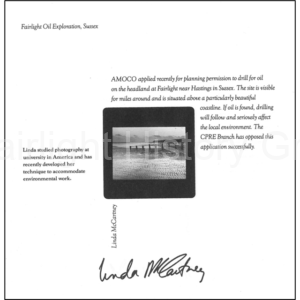
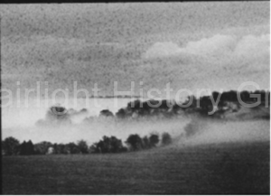
The protestors’ cause was even helped by Linda McCartney, then living locally.  She helped the FDCS by allowing a postcard of one of her photographs – “mist-shrouded Fairlight Down” – to go on sale in aid of the fighting fund.  Another picture was one of 24 photographs in the exhibition at the Royal Festival Hall in London on England’s Endangered Landscapes organised by the Council for the Protection of Rural England. 

This is the relevant page from the subsequent book “England’s Glory/Vanishing England” from 1987.

Hastings’ then MP, Ken Warren, supported the protestors saying:  “I do not think it is an appropriate site even if all the oil in Texas is under it.” (HSLO, 16 January 1986).

Hostile public opinion grew rapidly, so much so that the meeting of the Hastings development committee to debate the issue was moved to the White Rock Theatre to ensure enough space for the expected turnout of protestors and objectors, whose case was supported by the Nature Conservancy Council.  The debate was vigorous and the opposition vociferous.  And fortunately the politicians listened.

The matter was finally decided by East Sussex County Council – as the Financial Times of 4  April 1986 reported:

 “Amoco, the US oil company, has been rebuffed in its plans to drill for oil and gas in a beauty spot near Hastings, Sussex.
It is the first time East Sussex County Council has refused a company permission to drill in a region viewed by the international oil industry as having great potential for oil and gas discoveries….East Sussex county council said yesterday the proposed drilling site, at Fairlight, was within the High Weald area of outstanding natural beauty, close to Hastings Country park and to a residential area.”


So, in the event, the oilmen were seen off and the nightmare of fields full of oil pumps was no more than a bad dream. 

But, as we see in today’s context, rather like the mythical hydra which Hercules encountered, once one threat is seen off, others grow to replace it.  And, if the oil threat were to return, who can say whether in 2019 the outcome would be the same?  We must be vigilant.

By Haydon Luke


A New Town at Fairlight?

A NEW TOWN at FAIRLIGHT? By Haydon Luke

No, this is not a piece of polemic about the current proposals for the Wakehams Farm site – though history shows that grandiose plans for building in the Fairlight landscape are nothing new.  And as we know, at different times in the past, Fairlight has had some narrow escapes from proposed developments which, had they been carried through, would have altered completely the character and nature of our parish. 

One of the earliest threats, had it materialised, would have seen Fairlight become the site for a Hastings New Town!  And this act would have been carried out not by a post-World War 2 corporate state but by our Georgian ancestors – the same Georgians who built such elegant urban landscapes as at Bath and Brighton. 

To understand the story we must go back to 1830 at which time the Warren Farm estate of some 577 acres came on the market. 

At first glance it seems innocent enough; an advertisement designed to attract a gentleman of means to invest in some “most excellent Pasture, Meadow, Arable, and Wood Lands, lying exceedingly compact…about Two Miles to the Eastward of Hastings Fashionable Town.” 

The potential purchaser has his attention drawn first to “a very snug Little Residence,” and then to the situation which is “contiguous to Fairlight Church.”  Having reassured the potential purchaser as to the comfort that Warren Farm will afford to body and soul, the advertiser describes the profitable farming opportunities the estate offers.

From material in The Keep (ESRO FAA/ACC5500/1/19) – particulars of Church or Warren Farm in Fairlight for sale at auction…22 July 1830

The time is the 1830s, however, and English agriculture is in the doldrums – possibly the reason why the owner is trying to sell the estate in the first place.  So what other inducement can the vendor’s agents put before potential purchasers?  The resourceful auctioneer casts his eye about him and his glance falls upon the nearby and successful new town lately (1828) being constructed close by in St Leonards by James Burton. If the Hastings area can support one fashionable and elegantly conceived new town, he surmises, why not two?

The main thrust of the remainder of the particulars suggests to a potential purchaser that he has the opportunity on the Warren Farm Estate, should he have the perspicacity to appreciate it, “no less an object than creating on this fine domain THE NEW TOWN OF HASTINGS.”   Indeed it is suggested that the Fairlight new town has the potential to eclipse Burton’s St Leonards. 

The particulars then go on to outline the ways in which a new town at Fairlight has the qualities to outdo St Leonards by virtue of so many attractive features; “hill and dale…wood and water, of lofty height and quiet repose…a valley of inconceivable beauty…unpretending yet delightful seclusion…nearly one mile and a half of Frontage to the Sea Shore, and sands so inviting that the most timid could not resist them.”  Having warmed to the subject with as much skill and enthusiasm as any later copywriter from Madison Avenue, the writer poses the clinching question “who could resist a Villa in such a situation?” and then subtly spices his inducement with the scent of profit when he opines that “he must be a bold Arithmetician who can safely place a limit to the pecuniary gains consequent upon such a plan.”

In the event it seems that despite the promise of potential profits no one of sufficient means could be persuaded to invest in order to enable the grand design.  Consequently, the vision of a Fairlight of classical Italianate villas populated by families of quality never materialised.  Within a few years Warren Farm became part of the Lucas-Shadwell estate centred on Fairlight Hall.  It would need almost 100 more years and the consequences of a world war before new developers in a different century started to lay out roads, not for classical villas but for the bungalows that became Fairlight Cove. 

By Haydon Luke

Channel Watch

Channel Watch

by Haydon Luke, Fairlight History Group.

In the late autumn of 2020, observant visitors to the Country Park and those living in the Coastguard Cottages noticed something unusual – the radar scanner had stopped turning. What had been an ever-present background feature of life in the Country Park at Fairlight for as long as most people could remember, had ceased. For those who noticed (and many apparently didn’t) the question was ‘what’s happened?’

An enquiry to the Maritime and Coastguard Agency headquarters eventually elicited the information that:

“HM Coastguard is aware that there is a technical issue with a channel radar at the Dover Straits and we are currently working to resolve this issue.

‘Owing to its design, there is an overlap in the provision of this radar located on this section of the coast.

‘Cover is – and will be – maintained throughout the period of repair to the radar at Fairlight to ensure operational capacity is not affected.” (Email from MCGA Press Office, 17/12/20)

No surprise, then, when that very same day an impressive array of vehicles, including a giant crane, appeared at the end of Coastguard Lane and started the process of removing the faulty scanner and installing a (temporary) replacement.

The whole process was completed with great skill and precision and within 24 hours the scanner, a slightly different pattern from the previous, was turning again.

The process will be repeated later in 2021 when the old scanner, duly repaired, is reinstated. Meanwhile, the Channel watch from Fairlight continues, as it has done in more or less unbroken succession since the Middle Ages.

Since earliest times, men have used high points on land and at the coast to keep watch and to pass messages or warnings from one high point to another.  Greeks, Romans and Persians certainly used those methods.  We cannot be sure that the Romans used Fairlight in this way, though because it is such a good site for a signal station chances are they did. 

The evidence from more recent times for Fairlight’s use in this way is compelling.  In the 14th century for example, during the wars with the French, orders to erect fire signals, ‘with watchmen and sentinels in all proper stations’, were sent to the sheriffs of nearly every county in England including Sussex.” (1324) Further orders issued in 1337 and 1338 detailed that the fire signals should be made ‘as well upon the hills distant from the sea as in other places near the sea coast, and as often in such places as shall seem to (the sheriffs) expedient, and as was formerly wont to be done . . . and lighted as often as danger shall threaten.’  The beacons were to be guarded by ‘four, five or six men at arms or armed men’. (Kitchen, F, The Ghastly War Flame, Sussex Archaeological Collections, 124, (1986), 179-81)

What is not clear is the exact location of the Fairlight beacon – whether it was on Fairlight Down roughly where North’s Seat is, on the church tower, or whether it was where the radar scanner now stands or some other location.

What is clear is that over time the use of beacons became routine.  Beacons were in use, for example, at the time of the French attack on Brighton in 1514 and they are firmly fixed in the popular imagination by their use at the time of the Spanish Armada in 1588.  It is a map from that period that provides the evidence that Fairlight was a crucial and established part of that system. 

As part of the preparations for the war with the Spanish, the authorities in the counties fronting the Channel were required to ensure that the beacons were ready.  In Kent, William Lambarde was the man who made the survey, and his map of 1587 clearly shows Fairlight as a key link between the beacons further west and the network of sight lines which would convey the signal to the Medway and to the government in London.

At the time of the Jacobite Rebellion in 1745 there was a danger that Charles Edward Stuart, the young Pretender, would lead an army of invasion from France to reclaim the throne whilst George II was away fighting in the Low Countries.  And so, on Christmas Day 1745, Admiral Vernon wrote to the Churchwardens of the Parish of Hastings: “As it would be for His Majesty’s Service to have a speedy Communication of Intelligence either by night or day, of the enemy’s appearance, with any Embarkation for attempting to invade His Majesty’s Dominions, I desire that you would write letters to the respective Churchwardens of the Parishes, and here undermentioned, to hoist a flag upon their church steeple, as a signal for it by day, and keep a fire alight in an iron pot, as a signal by night, at the same place, to be repeated from the respective churches for communicating the Intelligence from Beachy Head to the South Foreland…1st The churches and castles from the South Foreland to Beachy head were: Dover Castle, Folkestone Church, Sandgate Castle, Sandgate Church, Rye Church, Fairlee (Fairlight) Church, Pevensey Church, The Ness (Dungeness).”

By the 19th century, however, beacons had become ceremonial and celebratory, such as those marking various royal jubilees in Victoria’s and our own Queen’s reign. 

Although the role of beacons in coastal defence diminished as the years passed, the need for coastal vigilance itself did not.  The need became greater as smuggling became more of a problem for the authorities. Increasingly, too, the responsibility passed from parishes and churchwardens to other organisations, and the military character of these increased.

But whether those watching were civilian or military, the need for keen eyes and a reliable method of signalling remained paramount for the coastal watch.  By the end of the 18th century smuggling was out of control. It was estimated that about two thirds of the brandy drunk in England had been smuggled in!  There is absolutely no doubt that some of this came via Fairlight and the paths up from the beach in the Country Park, especially Fairlight Glen. Smuggling and war intensified the need for watchers.

In 1795, during the war with France, the Royal Navy set up a series of signal stations all along the south and east coast of England.  The signal stations would communicate intelligence through a series of marks on a flagpole and outriggers. Signals by flags and balls were communicated to and answered by ships at sea. The stations were managed 24 hours a day with signals being made by fires and blue lights at night-time. The sketch shows the general character of such stations and the one here in the Country Park would have been similar. Though primarily military, soon their value for general coast-watching purposes was recognised by the authorities.

These arrangements were eventually consolidated into an organisation known as the Coast Blockade, staffed by demobilised sailors from the Royal Navy.  The Blockade’s methods were often tough and proved to be the most effective yet against smugglers.  This scheme lasted until 1831 when it was absorbed into the Coast Guard.  Over the next 100 years or so their duties gradually expanded from anti-smuggling and coast defence into humanitarian duties such as life-saving and rescue, and the management of wrecks and much else besides. 

The station we are familiar with in the Country Park at the end of Coastguard Lane was originally developed as part of the Coast Blockade and would have been like the one in the sketch.  Later, with the establishment of the separate Coastguard service, the row of cottages was added around 1900.  The proliferation of Coastguard cottages in Fairlight (and at Pett Level) is evidence of the importance of the security of this stretch of coast to the authorities and of the need to have many pairs of eyes on watch. So, from east to west there were blocks of cottages and their associated look-out stations at Pett Level (originally housed in Martello tower no.38), Cliff End, at the Haddocks (eastern end of Fairlight Cove), at the end of Coastguard Lane (where the radar scanner is now), and at Ecclesbourne Glen in the Country Park.  Five stations on a three mile stretch of coast, plus, from 1927, a small lookout on the Fire Hills – the remains of which still exist.

 The sea took its toll of some of these stations – the one in the Martello tower No.36 at Pett Level became unusable when the structure began to break up as the shingle moved and that in tower 38 at Cliff End, Pett was blown up by Royal Engineers in 1872, whilst that at Ecclesbourne Glen became uninhabitable in winter storms in early 1859.  New cottages were built further up the cliff there and they survived until the early 1960s when further cliff falls had made them uninhabitable. In any event, the Coastguard had all but abandoned Ecclesbourne as a station by 1910.  Pett Coastguard Station was sold off in 1926, and by 1933 Fairlight was the only constant watch station between Newhaven and Dungeness.

The Second World War and the years thereafter of the ‘Cold War’ gave a new impetus to the Coastguard, and the Fairlight Station was modernised in 1971, in the process receiving a visit from the Duke of Edinburgh on 25 June.  At that time it had 9 volunteer watchmen and 15 in the rescue section.

From a peak in the early 1970s, however, the Coastguard was steadily reduced in manpower so that by August 1982 Fairlight was downgraded to a secondary station with merely two Coastguards and with the lookout being manned only during bad weather and when searches were active.  On 1st April 1998, the Coastguard merged with the Marine Safety Agency to become today’s Maritime and Coastguard Agency (MCA).  The only remaining station locally is the sector office at Rock a Nore in Hastings, opened in October, 1990.

As time passed electronic surveillance and helicopters, backed up by mobile patrols, supplanted the keen eyes of teams of local men on watch.  More recently still the MCA has now established an automatic identification system (AIS) network around the UK coast, for real-time tracking and monitoring of shipping movements from the shore. With the development of all these technologies the need for shore stations diminishes.

The Fairlight station was a casualty of this progress and the lookout tower (seen in the picture at left in the winter of 2005) was finally dismantled in 2012.  But Fairlight’s continued importance in the wider scheme of things, for the time being at least, is testified to by the presence of the constantly rotating radar scanner at the end of Coastguard Lane. Which is where we came in.

So, for now, but for how much longer, the scanner in the Country Park remains – one of three (the others are at Margate and at Dover) – covering that busiest of all shipping lanes, the eastern English Channel? 

By Haydon Luke

Fairlight and The Bronte Connection

Fairlight and the Brontë Connection by Haydon Luke

For 85 years there has been an important connection between the village of Fairlight and the village of Haworth in West Yorkshire, best known as the location of Haworth Parsonage, home of the Brontë family.  Yet few people hereabouts are aware of that connection with one of the most celebrated locations in England’s literary heritage.

So what is the connection?  For a clue you have to look in the churchyard of St Andrew’s.  Unusually, however, the informative booklet entitled The Victorian Churchyard, available at the Church, does not supply the clue.  This, too, is surprising because the booklet (re-written and collated by Vi Britton and her team a few years ago) is extremely informative about the stories of the various interesting figures of local and national significance who are buried there.

To begin to make the connection, it is necessary to walk through the churchyard to the north hedge adjacent to Battery Hill.  There, about halfway between the Lych Gate and the North West corner of the churchyard, close to the rusty iron railings, you will find a substantial double grave in good order.

Look at the grave carefully and you will see that it is inscribed: “In memory of Sir James Roberts, baronet, JP, LLD, the Hall, Fairlight, formerly of Saltaire, who passed away on Dec 31st 1935, aged 87 years.  And Lady Elizabeth Roberts, his beloved & devoted wife for 62 years: who passed away on July 27th 1935, aged 82 years.  And their Grand-daughter Kathleen Mary Roberts Berlyn, Dec 15th 1905 – Jan 28th 1990.”

So what is the story which brings together the family that owned Fairlight Hall in the 1920s and 30s with the Haworth home of the Brontës – because on the face of it there is no obvious linkage? The following information is culled from several sources including the Brontë Museum, the Roberts family website and various newspapers of the time.

Sir James Roberts, born 1848, came from a large and poor farming family living near Haworth, West Yorkshire. He was the eighth out of eleven children to survive infancy and was the youngest son.  He attended the church school in Haworth that had been set up by the Rev. Patrick Brontë, then went to work at Saltaire Mill (owned by the legendary wool millionaire Titus Salt) a few miles away near Bradford. He was just twelve years of age, which was then the legal minimum age for such employment, allegedly walking barefoot across the Moors to reach the mill.

James clearly applied himself most diligently because at eighteen or so he was made manager of the mill. Lacking formal schooling he had nevertheless taught himself fluent Russian, journeying to Russia each year to trade cloth for angora wool since Saltaire used both angora and alpaca wool in its fine cloth which sold well in the rich markets of pre-revolutionary Russia.

When the son bearing Sir Titus Salt’s name died prematurely, Saltaire became owned by a consortium, one of whom was James Roberts. Eventually he bought out his partners and established his large family in Milner Field, Bradford, the house built by Sir Titus Salt’s son.

In 1909 he was made a baronet, his wealth multiplied and, a year later, he bought Strathallan Castle (which the Roberts family still owns) in Scotland from the Earl of Perth. He continued Sir Titus Salt’s Utopian ideals for the model mill town of Saltaire, investing heavily in upgrading and modernising the mill itself to such an extent that his mill workers presented him with an elaborate golden casket celebrating his leadership.  The casket was highly decorated, with the image of Saltaire Mill on the outside amidst scrolls wrought on the gold, and inside a scroll of parchment.  

Sir James Roberts in later life                    Sir James and Lady Roberts at Fairlight Hall, reproduced by permission of Julia Bolton Holloway

His travels to Russia continued and he had great faith in that nation, leading (mistakenly as it turned out) to his investing his wealth in enterprises such as railroads aimed at modernizing Russia. He also established a Chair of Russian at Leeds University in 1916. In gratitude Leeds University bestowed on him an honorary Doctor of Law degree.

However, disaster struck when, in 1917, as a consequence of the Bolshevik Revolution, he lost the greater part of his vast wealth which he had invested in Russia. There were family tragedies, too, including the premature deaths of several of their children not least that of Sir James’ youngest son, Jack, who drowned tragically on a family holiday in Ireland, aged 10. So Sir James and his wife sold Saltaire and eventually came to live quietly at Fairlight Hall which they purchased in January 1926.  And it was whilst living there that his wife,  Elizabeth, noticing a piece in the Yorkshire Observer reporting that Haworth Parsonage was for sale, suggested he buy it and give it to the Brontë Society for the nation so that it could become a museum.  This he did, for a cost of £3000, 93 years ago, in 1928. Both Sir James and his wife Elizabeth, Lady Roberts, journeyed back to Yorkshire for the occasion.

Haworth Parsonage, below, and , left, photograph from The Keighley News, Saturday 11th August, 1928, showing Sir James and Lady Roberts and other dignitaries at the ceremony to hand over the Deeds to the Bronte Society.

Sir James and Lady Roberts are buried together in the graveyard of St Andrew’s Church.  From their tomb you can look through the trees to the valley of their last home where, in the tranquillity of Fairlight, a generous idea was conceived which led to the preservation for all time of the home of one of England’s most celebrated literary families.

By Haydon Luke